
 The popular image of a highway is of a modern, limited-access interstate structure. Government financed and maintained, these multilane transportation corridors cut wide swaths through the rural or urban landscape. The Dixie Highway was none of those things when it was first conceived and developed in 1915. Planned as a way for northern automobile tourists to drive to Miami, the Dixie Highway had its origins as a privately-organized, stitched-together network of existing roads extending from Michigan to Florida. In time, the popular highway was subsumed by the numbered highway system and later the interstate system. Some sections became part of modern networks. In Georgia, it is embedded in highways such as U.S. Routes 1, 11, 17, 19, 41, and 129. Other sections were left as remnants as highway design and bridge engineering evolved. Despite this fragmentation, the Dixie Highway persists in place names and local memory, indicating the transformative power it possessed for multiple generations of Georgians.
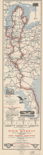
1915 Map of the Dixie Highway
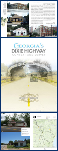
Although widely studied by historians, little is known about the road’s complex historic geography. The road is also popular with the public, particularly among those nostalgic for an earlier age of automobile travel and others fortunate enough to have driven on it. Hundreds of planned road improvement projects could intersect with surviving segments of the Dixie Highway, requiring them to be identified and evaluated. Recognizing the historic significance of the Dixie Highway and the need for a plan that would allow for effective stewardship of the road as a historic resource, the Georgia Department of Transportation (GDOT) and Federal Highway Administration (FHWA) engaged New South Associates to prepare a planning document entitled Georgia’s Dixie Highway, Context and Survey.
The Dixie Highway context study was a multi-year project that researched the Dixie Highway, surveyed the state to identify surviving segments of the historic road, and develop a plan that would assist GDOT in managing the road as a historic resource. An important element of the project was a program of public outreach throughout the state to inform the public about its objectives and to learn from the communities that once hosted the highway about the important storylines it represented locally. The public was kept up to date on the Dixie Highway by visiting the Facebook page. The historic route of the Dixie Highway in Georgia was recreated by collecting and organizing historic maps in a Geographic Information System (GIS) mapping database and georeferencing probable routes. Using the historic map analysis, a route was determined to guide a field survey that resulted in a description of preserved portions of the Dixie Highway. The survey also identified numerous auxiliary property types, such as bridges, signs, gas stations, hotels, and sites that comprised critical elements of the Dixie Highway’s history.
Interest grew out of the the study and outreach programs. Georgia Public Broadcasting worked with New South Associates and GDOT to explain the rich history of the Dixie Highway in a documentary, Down the Dixie Highway, you can access below.