
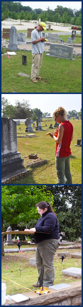
 As part of New South Associates’ Mortuary Archaeology Program, cemetery mapping and recording is provided for a variety of clients including city and county governments, cemetery associations, descendant communities, and private developers. Mapping and recording a historic cemetery is the first step in developing a cemetery restoration and management plan as well as assuring the respectful and appropriate future use of a cemetery’s landscape. New South Associates employs a Topcon total station to create cemetery maps allowing highly accurate maps to be prepared that incorporate topography, trees, tombstones, paths, and plot boundaries. Maps can be produced in Surfer or incorporated into GIS; GIS applications allow our clients to search and display burials from a given time period, family, or other association. Once mapped, the next step is to create a record of each burial marker using a customized cemetery database developed on a Microsoft Access platform. New South Associates records burial markers in the field on tablet computers. The burial record also includes the condition of the marker, vegetation, grave offerings, and a digital photograph. Condition information can be expanded to included recommended restoration and treatment procedures.
New South Associates recommends that cemetery mapping and documentation studies be augmented with historical research and developed into Cemetery Management Plans. Combining the information collected from archival and oral history sources with information on the cemetery’s landscape, these plans outline the restoration efforts needed for the cemetery as a whole, as well as for individual graves. Management Plans are recommended for the care and treatment of historic cemeteries and can also present interpretive approaches that sensitively treat cemeteries as heritage tourism destinations.